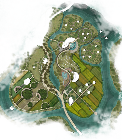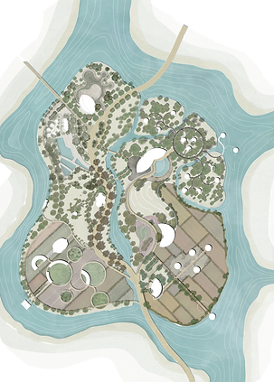
Combining Landscape Project
Long An holds an advantageous position within Vietnam's Southern Key Economic Region, acting as a vital bridge that connects Ho Chi Minh City in the northern direction and traverses through 12 provinces of the Mekong Delta to the south. The province shares its western boundary with Cambodia while the expansive East Sea (South China Sea) graces its eastern expanse.
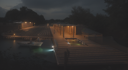
It is an island but does not isolate people
This region is characterized by its low-lying coastal topography. Consequently, certain parts of Long An are prone to flooding, predominantly during the rainy season which persists from the inception of August until November.
The province boasts a network of numerous rivers, with key ones including Vàm Cỏ Đông and Vàm Cỏ Tây. These rivers intricately link with the Tien river, culminating in a larger and interconnected river system. Another vital waterway in the vicinity is the Soài Rạp.
Given its coastal disposition, Long An remains especially vulnerable to the escalating sea levels attributed to climate change. To address this concern, the Climate Change Research Institutes at Can Tho University play a pivotal role in understanding and responding to these environmental shifts.
Long An province
Complex Residential Landscape, Studying project
2020